Dr. Geoffrey McCafferty


By Geoffrey McCafferty (2009)
In order to identify and evaluate possible archaeological resources, an initial program of shovel testing was done around the bridge over Swan Hill Creek. The terrain on the east side of the creek was heavily overgrown, with minimal surface visibility, whereas the west side of the creek included maintained yard lots. Shovel testing identified multiple artifact concentrations, labelled 'loci".
Locus 1 was located in the northeast quadrant of the project area, and consisted of late-19th century artifacts, butchered animal bones, and architectural rubble. Excavations identified intact, dry masonry wall foundations (Fig 1). No structures are identifiable for this locale on any of the historical maps, but the Wixsom photographic archive depicts a wooden structure on this property. Based on the material culture, Locus 1 is interepreted as a short-lived residence.
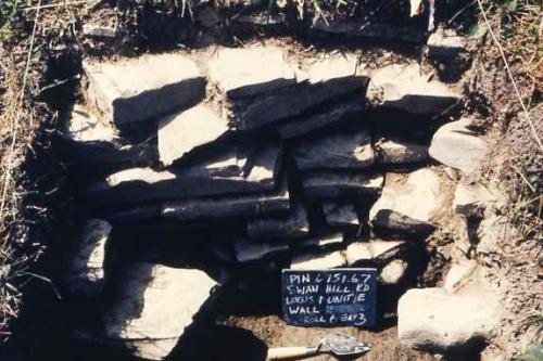
Figure 1: Locus 1 wall foundation
Locus 2 was located in the northwest quadrant of the project area, along the main street of the town. Based on the 1857 map, it probably corresponds to the S & G Mill. There were large, well built foundation walls (Fig. 2), and a thick concentration of industrial refuse deposit (Fig. 3). A well was discovered that had also been filled with refuse (Fig. 4), including parts of a Model A automobile, milk cans, and a baby carriage. The refuse consistently dated to the early 20th century, suggesting that the mill may have served as a garbage dump in the final years of the community.
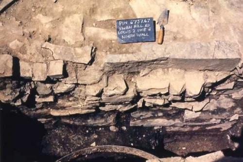
Figure 2: Foundation wall of mill
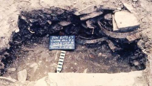
Figure 3: Deposit of industrial refuse as foundation fill at Locus 2
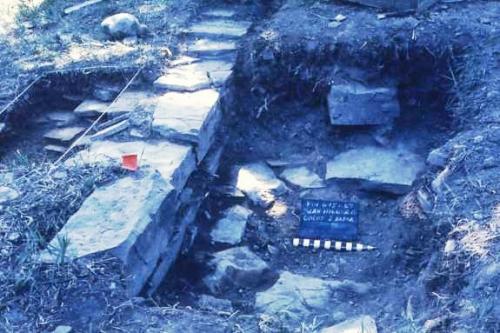
Figure 4: Outline of circular well in front of foundation wall
Locus 3 was also located in the northwest quadrant of the project area, on the west side of the road leading across the Swan Hill Creek bridge. Historic maps and images from the Wixsom photographic archive showed this to have been a commercial district, including a blacksmith shop. Excavations discovered the foundations of several adjacent buildings (Figs. 5 & 6), and especially deposits associated with the blacksmith (Figs. 7 & 8). An area behind the shop featured a thick deposit of coal ash and clinker, mixed with hundreds of snipped horseshoe nails. There was also a round metal object in an area of fire reddened soil that was interpreted as part of the forge. Interestingly, the scrap heap included many metal parts from horse buggies. The timing of the blacksmith shop in the late 19th and early 20th centuries means that there may have been adjustments in action as the owners/smiths shifted from horses to motorized vehicles.
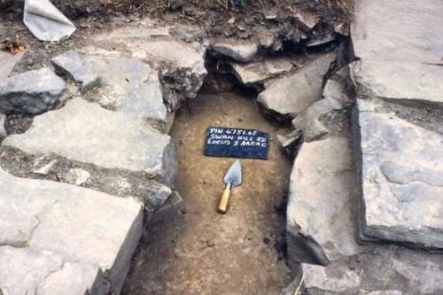
Figure 5: Space between two shop walls in Locus 3.
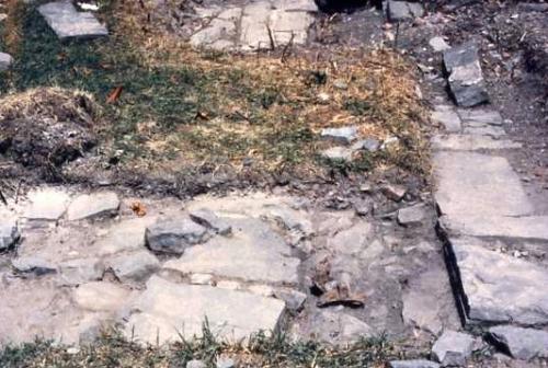
Figure 6: Wall and paved floor of blacksmith shop
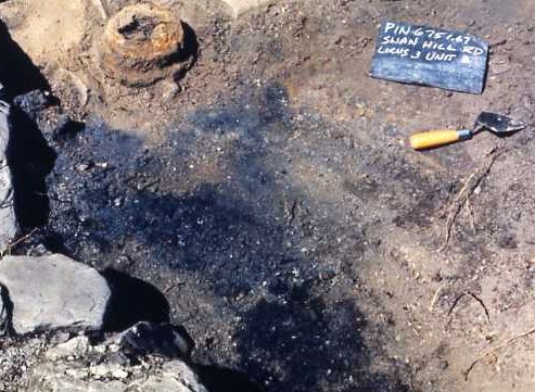
Figure 7: Work area behing blacksmith shop, including remains of forge
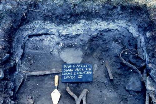
Figure 8: Scrap heap and ash dump behind blacksmith shop
Across the street from Locus 3 was Locus 5, where domestic remains indicated a yard midden probably associated with the residence on L.B. Herrick (1874 map). Excavations also encountered remains of a small structure that was likely the outbuilding shown on the same map. The floor was made of split but unfinished logs, where the bark was visible in the side wall of the excavation. A high abundance of small nails suggest that the small structure may have been a specialized shop, probably of a cobbler.
One final locus received intensive excavation. Locus 12 was located at the far northeast part of the project area. A concentration of domestic artifacts indicated another residence, probably that of H. Wood from the 1874 map. Excavations encountered part of a foundation wall (Fig. 9), and also a stone-lined well (Figs. 10 & 11).
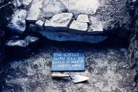
Figure 9: West wall of structure
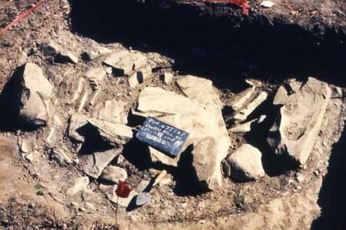
Figure 10: Well filled with stone rubble and architectural debris
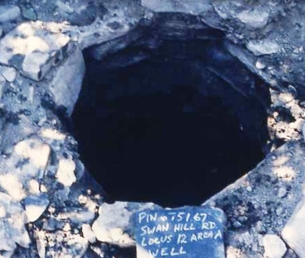
Figure 11: Locus 12 well after removing debris
The excavations at historic Alpine provided an interesting insight into a rural community that prospered and then faded over a span of just over 50 years. Several mills were established along Swan Hill Creek, exploiting the lumber of the nearby forests. The town built up around that prosperity, including a hotel for visitors, and several commercial ventures. Of particular interest was the blacksmith shop as it reflected technological and economic factors with the advent of the automotive age. The final nail in the economic coffin seems to have been a politically motivated decision to by-pass the town with the rail line. A clue to why this may have occurred was found in the historic photos of the Wixsom Archive, which featured a prominent 'Greenback" pole indicative of the Greenback movement